
How Geology Has Shaped The Land Of Waterfalls
Gorges State Park is centered on a track of Southern Appalachia where fresh mountain water bubbles abundantly out of nearby springs and the waterfalls are just as abundant as the incredible landscapes.
Visitors from all over the country come to western North Carolina to fish these pristine rivers, kayak down aggressive spats of whitewater, or to take photos of the hundreds of waterfalls that roar throughout the Blue Ridge Escarpment, but why is it that we have so many of these waterfalls here?
An escarpment, generally, is defined as an “area of the Earth where elevation changes suddenly.”
There are escarpments all over the world; the 1,000-foot tall, 200-mile-long Mogollon Rim which separates Arizona’s high and low deserts, the hundreds of miles of sea cliffs in Oregon, and even Niagara Falls itself sit upon escarpments.
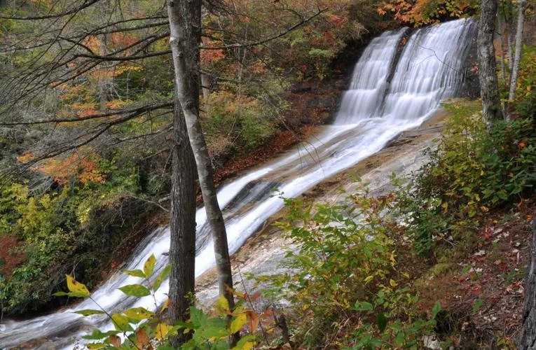
Upper Bearwallow Falls in Gorges State Park. (Courtesy photos by Kevin Bischof, Gorges State Park superintendent)
The Blue Ridge Escarpment, or “Blue Wall” as the Cherokee used to call it, stands over 2,000 feet above the valley floor in some places and in others can aggressively drop that entire height in less than a mile-and-a-half!
These sprawling cliffs are all produced either by erosion or by a geological process called faulting. Erosion is when rock and soil are battered by winds and rain.
On a small scale this can mean a particularly rainy-day washes mud into your driveway or causes trees to fall because the ground underneath them has been weakened. But when occurring on a scale as big as the Earth is old, it can result in entire mountain ranges being reduced by thousands of feet in height as their peaks are slowly and continuously shoved downhill into the surrounding valleys.
Faulting, on the other hand, tends to happen more quickly than erosion, as fragmented pieces of the earth collide with one another underground creating entirely new landscapes out of fractured tectonic plates.
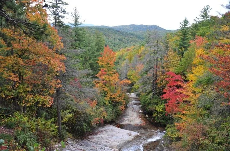
The Bear Wallow Valley is one of the scenic beauties in Gorges State Park
Gorges State Park and the Blue Ridge Escarpment are nestled in the Appalachian Mountains which are the oldest mountains on planet Earth, and that means there has been a lot of time to whittle-down its peaks which once stood as high as the Rockies.
Time has allowed the rivers on the Blue Ridge Escarpment to twist and wind their way throughout the Southern Appalachian Forest searching for the steepest terrain so that they may flow as easily as possible, and where there are steep cliffs and rivers there will certainly be waterfalls.
Transylvania County bears its name “The Land of the Waterfalls” specifically due to this principle (well, that and the fact it can rain over 100-inches a year in some areas like Gorges). Hikers can enjoy over one-hundred waterfalls in the county alone, and especially two of our most famous; Rainbow Falls and Whitewater Falls. Rainbow Falls is located within Nantahala National Forest and the trail leading to it is accessed through Gorges State Park. This 130+ foot roaring beauty casts rainbows all across the valley on sunny days. Whitewater Falls, the highest waterfall East of the Mississippi, is located just a few miles down the road.
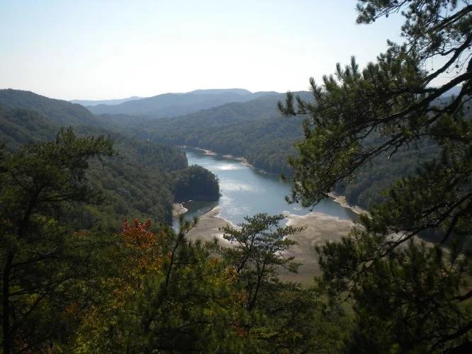
Lake Jocasse touches the southern end of Gorges State Park at the South Carolina border.
Waterfalls aside, centering Gorges on the Blue Ridge Escarpment also means there are incredible opportunities for large, scenic vistas on the edge of where the Appalachian Mountains stand.
The Visitor Center Trail to Upper Bearwallow Falls contains an observation deck where visitors can look out beyond the cliff’s edge, thousands of feet down below in South Carolina where Lake Jocassee and Lake Keowee now sit. Both lakes were created by Duke Energy which is the same company Gorges was able to acquire its land from so that we may all better serve to protect its beauty and pristine watershed.
The Blue Ridge Escarpment is where all the mountain spring water pours off into the foothills of South Carolina, and this means those who occupy the escarpment’s boundaries have an opportunity and responsibility to care for those waters which in turn serve all the surrounding, lower-elevation communities beneath it.
This makes it all the more beneficial that Gorges encompasses portions of not only the Horsepasture River where Rainbow Falls resides, but also tracks of Bearwallow Creek and the Toxaway River.
This means the waters and the nearly 8,000 acres which Gorges encompasses has been public land since its founding in 1999 and through careful management can remain both an incredible waterfall vista for travelers to enjoy as well as a bulwark to serve and protect the Blue Ridge Escarpment.